One of the members of the Adventure Cycling tour group was nice enough to lead me through town and then cutting through a parking lot to get to the bike trail. I would have had trouble finding it myself.
The first half of the day was on the American River bike trail. As mentioned in the Adventure Cycling errata sheet, the Jiboom St. bridge is closed for construction so you can't get across the river that way. I got a nice photo of it, but then I dropped my camera on the ground, which caused the little door to pop open and the battery to fall out. I retrieved the battery but didn't notice that the memory card popped out also. No problem, I brought along a spare SD card, but I did lose the first couple photos today.
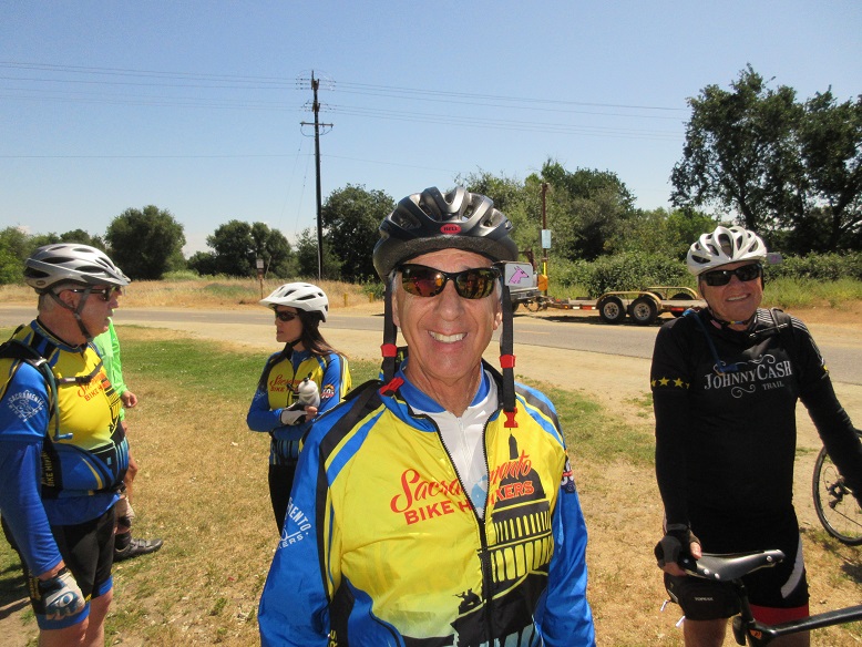
At one of the bathrooms along the trail I noticed a large group of cyclists, some of whom were wearing jerseys of the Sacramento Bike Hikers cycling club. I stopped to chat and found one guy who still remembered Sue from when she was active in the club 20 years ago. She helped design the jersey, although the design has changed a bit since then.
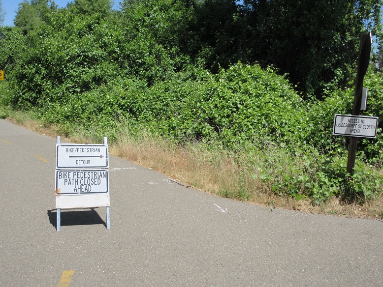
I did get a photo of this other detour. It was reasonably well-marked with "BIKE DETOUR" signs and I ended up on Natoma Street where I was supposed to be.
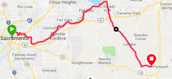
I finally figured out how to get the Garmin to guide my route using Adventure Cycling's GPX files that I had downloaded to it. On bike paths it is continually beeping and indicating turns that aren't really there. It thinks every sharp curve in the path is a turn. Before I figured that out, I was stopped trying to decide if I should really turn on a side path it was indicating when another rider with an (unloaded) touring bike stopped to help me out. He was very interested in my kit and Adventure Cycling. I showed him the map and when he noted that I would be on Latrobe Road, he nodded agreement and said that was a good way to go.
I don't know what his definition of a good route is, but it sure is different than mine. Latrobe has lots of hills, most of it has no shoulders, and there is lots of 55 mph traffic. I got honked at several times and got obscenities yelled out car windows. It was 15 miles of hell.
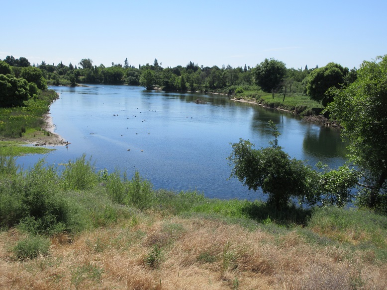
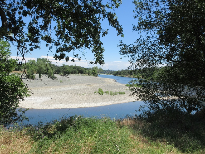
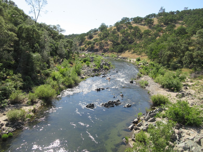
It did have a pretty view of the Cosumnes River where you cross over into Amador County.
I decided to stay in Plymouth tonight as a staging point for my ascent to
Carson Pass. There is no campground in Plymouth so I'm staying in the
Shenandoah Inn, which is why I have Internet access to post this blog.
I plan to do the climb in two stages, staying tomorrow night in Cook's
Station, halfway up.
The plan is to do Carson Pass in two stages. I had hoped to stay at Indian Grinding Rock state park, about half way up the mountain, but apparently they are closed until May 22. The Adventure Cycling map says there are a couple of camping spots behind the convenience store at Cooks Station, also about half way up, so that's what I'll aim for.
Last updated May 24, 2018