I have written extensive comments about the equipment I used on this tour, which are included elsewhere. Here are a few other general comments.
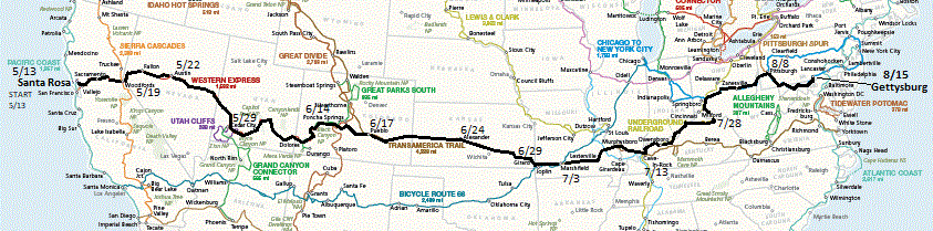
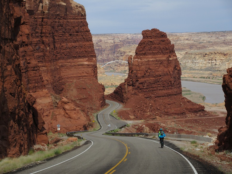
I would recommend the Western Express only to hardy, fit cyclists. The terrain is very mountainous and there are long stretches with no services. You need to start late enough in the year that you are not fighting snow drifts on Carson Pass but early enough in the year that you don't hit blazingly hot weather in the desert.
We hit some really hot, humid weather on the portion of the TranAmerica Trail that we rode, which was really challenging. The relentless short but steep hills of the Ozarks in southern Missouri made it even more challenging.
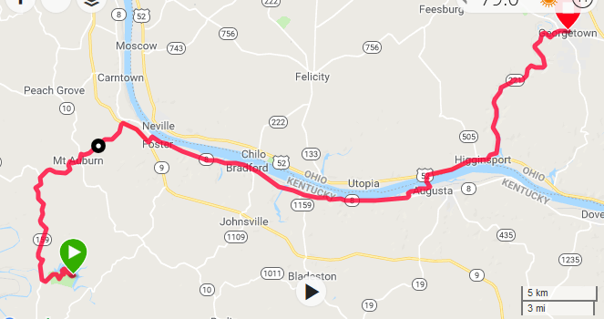
We shortcutted a portion of the Underground Railroad route from Kincaid Lake State Park north of Falmouth, where we took SR 159 north to pick up route 8 along the Ohio River east to Augusta, where we crossed the river on the ferry and then north to Georgetown OH where we again picked up the Adventure Cycling route. It was a nice alternative that cut off some miles and I believe some climbing as well.
From Xenia OH where we picked up the Chicago-to-NYC route, the first 125 miles or so are on rail trails, which are nice and flat. After that it gets hilly, worse than it looks on the map elevation profiles.
From Pittsburgh to Gettysburg is mostly flat bicycle trails. The Great Allegheny Passage (GAP) from Pittsburgh is on old railroad beds. It is not paved but has a smooth, well-rolled surface with good drainage. After Cumberland MD, the trail changes to the C&O Canal trail, built on the old canal towpath. It is more coarsely paved, is not well-drained and has many sections of mud. The area it goes through is very scenic and steeped in history but it is not a fun ride because of the mud.
After you leave the bike trail in Williamsport the rest of the ride is not very hilly except for the climb to Blue Ridge Summit, about 15 miles before Gettysburg.
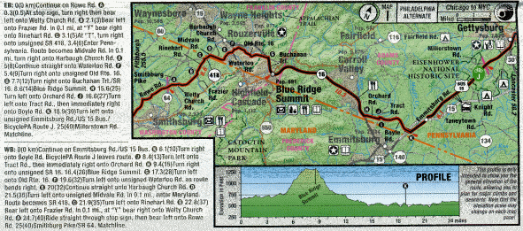
The Adventure Cycling maps use a narrative format for the route slips. For example, here's the route slip for the last complete map section of the trip, using the original formatting:
0(0 km)Continue on Rowe Rd (A)
0.3(0.5)At stop sign, turn right then bear
left onto Welty Church Rd. (B) 2.1(3)Bear left
onto Frazier Rd. In 0.1 mi, at "Y" bear right
onto Rinehart Rd. (C) 3.1(5)At "T" turn right
onto unsigned SR 418. 3.4(6)Enter Penn-
sylvania. Route becomes Midvale Rd. In 0.1
mi, turn right onto Harbaugh Church Rd. (E)
5(8)Continue straight onto Waterloo Rd. (F)
5.4(9)Turn right onto unsigned Old Rte. 16.
(G) 7.7(12)Turn right onto Buchanan Trl./SR
16. 8.6(14)Blue Ridge Summit. (H) 15.6(25)
Turn left onto Orchard Rd. (I) 16.6(27)Turn
left onto Tract Rd., then immediately right
onto Boyle Rd. (K) 18.9(30)Turn left onto
unsigned Emmitsburg Rd./US 15 Bus./
BicyclePA Route J. 25(40)Millerstown Rd.
Matchline.
I find that style basically impossible to read while riding, partly because of the small type but mainly because of the narrative format. You have to stop, put a foot down and read through the narrative to find and memorize the next turn. If you forget the information before you get to the next turn you have to stop, find the turn, and read it again.
So I make up my own route slips by typing the data into a spreadsheet and printing it out before the tour. Here's an example of what I would come up with for the above:
| 0.0 | Continue on Rowe Rd | |
| 0.3 | R/BL | Welty Church Rd at stop sign |
| 2.1 | BL | Frazier Rd |
| 2.2 | BR | Rinehart Rd at "Y" |
| 3.1 | R | unsgn SR 418 at "T" |
| 3.4 | S | Midvale Rd, enter PA |
| 3.5 | R | Harbaugh Church Rd |
| 5.0 | S | Waterloo Rd |
| 5.4 | R | unsgn Old Rte. 16 |
| 7.7 | R | Buchanan Trl./SR 16 |
| 8.6 | Blue Ridge Summit (R,CS) | |
| 15.6 | L | Orchard Rd |
| 16.6 | L/R | Tract Rd/Boyle Rd |
| 18.9 | L | unsgn Emmitsburg Rd/US 15 Bus. |
| 25.0 | Millerstown Rd on L |
I include some additional information from the maps that is not shown on the Adventure Cycling route slips. For example, in the above, the "(R,CS)" indicates that the town of Blue Ridge Summit has a restaurant and a convenience store. Sometimes I also include a fourth column to the right with mileage to the next turn, although I didn't do that on this trip. It's easy to have the numbers calculated automatically by the spreadsheet.
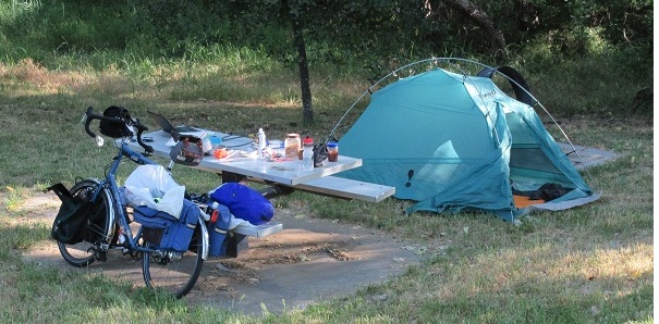
I generally prefer camping to staying in hotels. It is not so much to save money; two people can often stay in an inexpensive motel for not much more than the cost of a campsite. The thing I don't like about a motel is that you are isolated from the world. In a campground you not only interact with the great outdoors, you also interact with the other campers. That doesn't happen much in a motel.
Having said that, I find that on tour you often end up staying in hotels more often than you would like, for various reasons. Perhaps there is no suitable campground nearby, or it is raining cats and dogs and you have no dry clothes, or there is a tornado warning, or someone on the tour is sick and needs a warm place to sleep, etc.
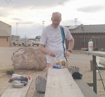 I like to cook meals in camp, for the camaraderie, for the satisfaction of
"do it yourself", and just because food consumed outdoors always seems to taste
better. Again I didn't do that as often on this tour as I would have liked.
Sometimes it was purely a matter of convenience. Another issue is that on a
tour with several people, not everyone likes the same food. Also the cook kit
that I brought is really only big enough for one or two people and we sometimes
had more than that.
I like to cook meals in camp, for the camaraderie, for the satisfaction of
"do it yourself", and just because food consumed outdoors always seems to taste
better. Again I didn't do that as often on this tour as I would have liked.
Sometimes it was purely a matter of convenience. Another issue is that on a
tour with several people, not everyone likes the same food. Also the cook kit
that I brought is really only big enough for one or two people and we sometimes
had more than that.
To get an idea of what is involved, just right click on one of my
blog pages and select "View Page Source"
(in Firefox) or "View Source" (Internet Explorer). For example:
<P>
To get an idea of what is involved, just right click on one of my
<A href=day01.htm>blog pages</A> and select "View Page Source"
(in Firefox) or "View Source" (Internet Explorer).  For example:
<P>
 Publishing in real time was difficult at times since I often didn't have sufficient
free time to do it and often didn't have Internet access. I needed the Internet
even to create the map files for each day (like the one in the Route section above),
since they were cut and pasted from the on-line Garmin Express program (that
uses data uploaded from my Garmin GPS). Once the next multi-day report was
finished I could then upload it the next time I was at a location with reliable
wide-band Internet access. I used the free FileZilla program to upload the files
to my web site.
Publishing in real time was difficult at times since I often didn't have sufficient
free time to do it and often didn't have Internet access. I needed the Internet
even to create the map files for each day (like the one in the Route section above),
since they were cut and pasted from the on-line Garmin Express program (that
uses data uploaded from my Garmin GPS). Once the next multi-day report was
finished I could then upload it the next time I was at a location with reliable
wide-band Internet access. I used the free FileZilla program to upload the files
to my web site.
The advantage of using a smart phone instead of a laptop is that
you do have Internet access wherever you have cell coverage. However, Greg
didn't have much success finding a good, powerful, easy-to-use app for
creating a bicycle tour blog. I suspect even if you could find one it would
not have as much flexibility in crafting your web pages as a laptop.
 I never fail to be amazed at how almost universally friendly and helpful
people are when you tour by bicycle. They buy your lunch, offer you
food and drink by the side of the road, invite you into their homes for
free lodging, and always act interested in this crazy thing you are doing.
I never fail to be amazed at how almost universally friendly and helpful
people are when you tour by bicycle. They buy your lunch, offer you
food and drink by the side of the road, invite you into their homes for
free lodging, and always act interested in this crazy thing you are doing.
As has happened in the past, when I finished the tour I felt a sense of
regret - I wanted to keep going! I'm already thinking about my next tour.
Perhaps in Europe this time. :=)
Last updated August 26, 2018