Philippine Adventure - Day 3
Thursday 9/7, Culasi to Boracay Island
47 miles
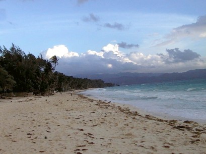
"The Beach at Boracay"
 Since I didn't get food poisoning at dinner last night I decided to
have breakfast at the same place. There were no breakfast items on the
menu so I settled for a microwaved hamburger and a Pepsi.
Since I didn't get food poisoning at dinner last night I decided to
have breakfast at the same place. There were no breakfast items on the
menu so I settled for a microwaved hamburger and a Pepsi.
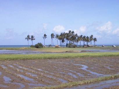
 As I rode today the heat and humidity were getting to me more than
usual, so I stopped frequently whenever I found a shady spot to rest
and cool off. The north-west coast of Panay Island seems less densely-
populated than the other parts I have seen. The places to buy Cokes
are farther apart, although I availed myself at almost every
opportunity.
As I rode today the heat and humidity were getting to me more than
usual, so I stopped frequently whenever I found a shady spot to rest
and cool off. The north-west coast of Panay Island seems less densely-
populated than the other parts I have seen. The places to buy Cokes
are farther apart, although I availed myself at almost every
opportunity.
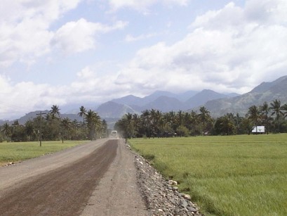 I was on unpaved road almost all day, except for the last 15 miles or
so. There was more sunshine and less shade than the last two days,
which explains my overheating problems.
I was on unpaved road almost all day, except for the last 15 miles or
so. There was more sunshine and less shade than the last two days,
which explains my overheating problems.
Somewhere between Sebaste and Pandan I saw a western-looking man
walking by the side of the road. I started to ride past, but a
Filipino yelled "Your friend!" and pointed to the fellow, who appeared
to be in his late 50's. So I stopped and chatted with him. As two
Filipinos looked on, he explained that he is a German living in the
area. Now, I studied German for a whole year in college 30 years ago,
so I'm something of an expert in the language. :=) Actually, I did
manage a short conversation. I don't remember everything we said, but
at one point I commented, "Wenn wir auf Deutsch sprechen, sie koenten
nichts verstehen." (If we speak in German they won't understand a
word!" The German was the first non-Filipino I had seen since leaving
Iloilo.
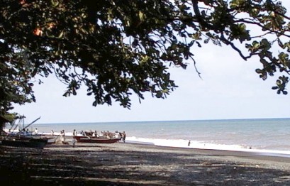
 I decided to have lunch in Pandan, but apparently I rode right through
it without noticing. (Most of the town is seaward of the "national
road.") I stopped at a roadside store and found a cold 1-liter bottle
of Coke. They gave me directions back to Pandan, but I misunderstood
and continued on in the same direction and then had to backtrack
several miles.
I decided to have lunch in Pandan, but apparently I rode right through
it without noticing. (Most of the town is seaward of the "national
road.") I stopped at a roadside store and found a cold 1-liter bottle
of Coke. They gave me directions back to Pandan, but I misunderstood
and continued on in the same direction and then had to backtrack
several miles.
Another lunch at a greasy spoon. Rice with some beef dish for a
topping. Again I declined the silverware in the cup full of water and
used my own.
After Pandan I had a choice of two routes to Caticlan, where you catch
the boat to Boracay Island. I could go west along the southern coast
of the peninsula via Libertad or north across the neck of the peninsula
to Nabas, then west along the north coast. The German had told me that
the Libertad road was very rocky. And my guidebook made a point of
recommending that you not take the through bus via the southern coast
but take the Kalibo bus, even though it means changing at Nabas. I
took both their advice and headed north.
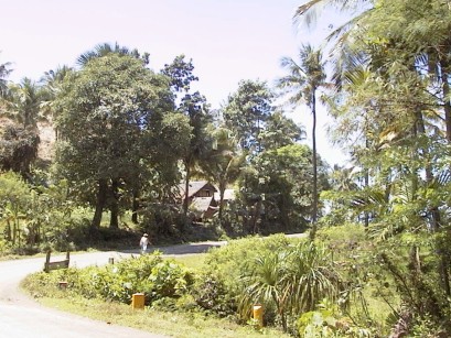 The road to Nabas was rocky enough, so if the other way is worse, I
made the right decision. After turning west, the north coastal road
had fine smooth pavement with even a paved shoulder most of the way --
the first time I have seen that on the tour. There was a fair amount
of climbing on this road, but it was a bit cooler so I didn't mind.
The road to Nabas was rocky enough, so if the other way is worse, I
made the right decision. After turning west, the north coastal road
had fine smooth pavement with even a paved shoulder most of the way --
the first time I have seen that on the tour. There was a fair amount
of climbing on this road, but it was a bit cooler so I didn't mind.
My map shows Caticlan as being right on the main road. (I later
noticed that the Tourist Dept. map shows it as being off on a side
road.) I was expecting to come to a little town with a harbor. I had
already passed where the town should have been based on mileage when I
saw a sign saying I was entering Malay, the next town along the road
according to my map. (A local later told me that Caticlan is the name
of the barangay, or barrio, part of the town of Malay.) So I stopped
to ask a passerby who said to go further down the road. I stopped
again to ask directions and they said just down the road and to the
right. But the next right was an obscure-looking dirt road so I
stopped a third time to ask some people standing on the corner, and a
young fellow said that, yes, that's the way to Boracay. He gave me a
business card for a hotel on the island and offered to show me the way.
He flagged down a passing jeep/taxi and told me to follow him up the
dirt road.
Of course they were soon out of sight and I was thinking that this
donkey trail through the jungle couldn't possibly be the way to the
world-famous Boracay resort. So when I came to an intersection where
it wasn't obvious which way to go I gave up and started back.
I didn't get far when I met a tour bus coming in the other direction!
So I quickly reversed course again and followed the bus. It wasn't
hard since the bus had to go very slowly over the ruts and rocks.
Soon, to my astonishment, we came to the "harbor" complete with food
and souvenir stands, ticket office and the government office where you
fill out the form required to travel to another island. There MUST be
a better route to this place. (No that's it, I later confirmed.)
 My new friend helped me with the paperwork and we both set off on the
pump boat, an old rust bucket (or it would be if it weren't made of
wood.) I was not at all sure about carrying the bike with loaded
panniers over the narrow gangplank, but a boatman did it for me for a 5
peso tip.
My new friend helped me with the paperwork and we both set off on the
pump boat, an old rust bucket (or it would be if it weren't made of
wood.) I was not at all sure about carrying the bike with loaded
panniers over the narrow gangplank, but a boatman did it for me for a 5
peso tip.
It turns out my guide's name is Ray and his family owns the
Bamboo Beach Resort that
he is taking me to. The price is 900 pesos a night for a
room with air conditioning, which is expensive by Filipino standards
but cheap ($20.22) by western standards.
The boat lands on the beach, and because the slope is so shallow you
have to wade ashore. However, they brought a smaller boat (for 10
pesos more) to take us the last few yards. I tipped another 10 pesos
to the guy who waded ashore with my bike. The boat fare was 25 pesos
for me and the bike, so the total crossing cost 50 pesos ($1.12).
Again, a lot by Filipino standards.
This time of year, the boat has to land on the east side of the island
because of the heavy surf at boat station 2 on the west side. So we
had to walk an extra kilometer or so to cross the island.
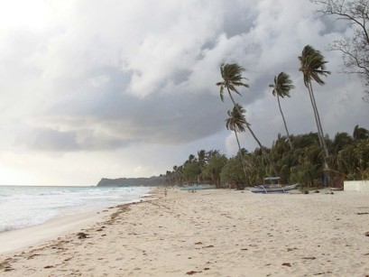 The famous 4-kilometer-long white sand beach on the west side is
fronted its entire length with wall-to-wall hotels, restaurants,
stores, etc. with the spill-over extending some distance inland. The
place is not crowded this time of year, but during the high season
hotel reservations must be made well in advance.
The famous 4-kilometer-long white sand beach on the west side is
fronted its entire length with wall-to-wall hotels, restaurants,
stores, etc. with the spill-over extending some distance inland. The
place is not crowded this time of year, but during the high season
hotel reservations must be made well in advance.
I was shown to my room by a hotel employee with the same name as me,
Alan. Again, there was no hot water or TV. (I never watch TV anyway
except to catch the weather). It was a nice room except for an
annoying leak in the bathroom ceiling which kept the tile floor
continually wet. Like the last place, there is no curtain or curb
between the shower and the rest of the bathroom so the whole floor gets
wet when you shower. At least the toilet seat doesn't get wet.
Because there is no seat on the toilet! That's what you get on Boracay
for 900 pesos. I could have stayed at the
Regency
for 130 dollars a night.
For dinner I had the buffet at the hotel. The dining room is a covered
open-air area between the hotel and the beach. The food wasn't great
but all-you-can-eat was just what I needed tonight (for 150 pesos).
So what's my impression of the famous Boracay? I should warn you that
I am not a "beach person" plus I was there during the rainy season.
But I wasn't all that impressed. If you want a spectacular but
over-developed beach, Waikiki is a lot closer. While all modern
services are available, the transportation, phone, and electricity
infrastructure is inferior. Still, the prices are much lower and if
you mainly want to lie on the beach by day and party by night, it might
be just the ticket.
Back - Top - Forward