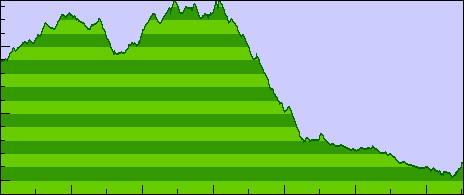
66 miles, 2297 feet of climb, 7707 ft max. elev. (200 ft/div)
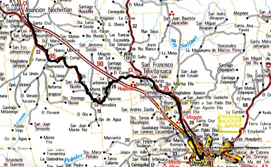
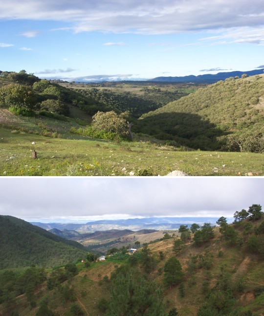 Both traffic and services were extremely light for the first 60-65 km of highway 190
today. Most motor vehicles take the toll road which is shorter and much faster. At km 70
I did find a nice restaurant for lunch with an outside patio so I could keep an eye on the
bike while I ate.
Both traffic and services were extremely light for the first 60-65 km of highway 190
today. Most motor vehicles take the toll road which is shorter and much faster. At km 70
I did find a nice restaurant for lunch with an outside patio so I could keep an eye on the
bike while I ate.
Traffic picked up quickly as I approached Oaxaca. It looked obvious on the map how to follow 190 right through town, but of course it wasn't so obvious in practice. Fortunately I had previously marked a waypoint on my GPS at Alejandro and Monica's house so I just headed in that direction until I saw a street name I recognized.
Nobody was home when I arrived about 2:30 so I let myself in with the key, took a shower, and started to sort through my stuff in preparation for packing.
They still hadn't returned by 7:45 so I hiked downtown to La Olla restaurant for dinner. I plan to take the family there for dinner tomorrow and I wanted to be sure I remembered where it is and confirm that my credit card is OK. It was a good thing I checked. I apparently had its location confused with the other restaurant where the SRJC group had met.
When I got back to the house they had returned and we talked for awhile. Everything is
arranged for comida for tomorrow at 2:00.