Today's ride was more of the same: 300 feet elevation gain in 88 miles. The cycle computer read zero feet of climb up to about the 55 mile mark. We are losing about 2500 feet every 100 miles for an average -0.5% grade.
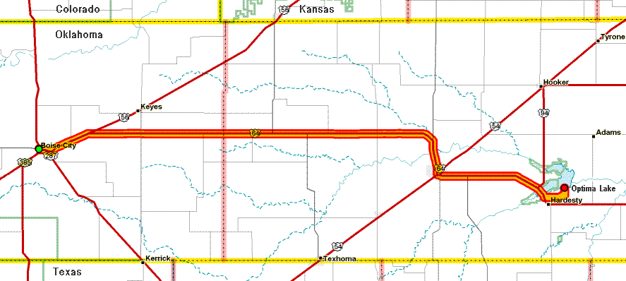
We planned to camp at
Optima Lake,
just east of Hardesty OK.
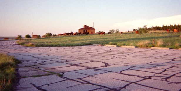
When we arrived, we found a totally deserted campground with
weeds growing in the cracks in the pavement. You might say that
Optima Lake is sub-optimum. We later found out that, due to the
long-term drought, lowering of the water table due to irrigation,
or Army Corps of Engineers' incompetence (we heard varying
explanations) the lake is almost empty -- we could see the
vestiges of it a half-mile away from where the shoreline was
supposed to be next to the camp.
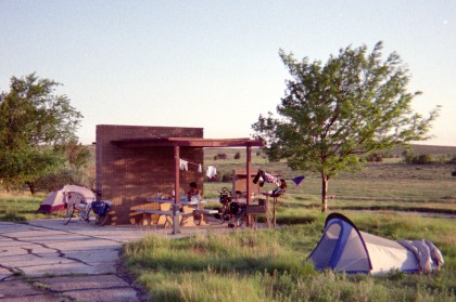
There was a sign at the entrance saying the campground is officially closed, but feel free to use it at your own risk. Well, the price was right, so we decided to spend the night.
Since the bathrooms were locked and nobody was around, we just
stripped and took a "shower" under the nearby water spigot. I
threatened Adam with my camera. I told him I should have shot
him with his own camera without telling him, but since I'm a nice
guy I didn't do that.